
Over the past decade, LiDAR technology has moved from a niche surveying tool to one of the most transformative sensing technologies across multiple industries. From autonomous vehicles and urban planning to environmental monitoring and agriculture, LiDAR is reshaping how we collect and analyse spatial data.
For businesses and organisations exploring advanced mapping and sensing technologies, understanding, “what is LiDAR?” is an important first step. Once the fundamentals are clear, it becomes easier to see why global investment in LiDAR systems continues to accelerate.
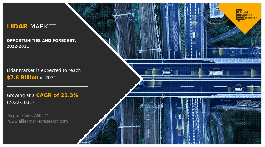
As industries demand more precise, real-time spatial data, the LiDAR market is expanding rapidly — and the next wave of innovation is already underway.
What Is Driving the Growth of the LiDAR Market?
Several major technological and economic trends are contributing to the rapid growth of LiDAR adoption worldwide.
Increasing Demand for High-Precision Mapping
LiDAR provides incredibly accurate three-dimensional data about the physical world. Compared with traditional surveying or photogrammetry alone, LiDAR can produce highly detailed point clouds that reveal terrain, structures, vegetation, and infrastructure with exceptional precision.
This level of detail has become essential for sectors such as:
- Infrastructure planning
- Urban development
- Construction and engineering
- Environmental monitoring
- Mining operations
- Disaster response planning
Governments, construction firms, and environmental agencies increasingly rely on LiDAR to support data-driven decision-making.
Expansion of Autonomous Technologies
One of the most visible drivers of LiDAR development is the race toward autonomous vehicles.
Self-driving cars, delivery robots, and autonomous drones all rely on highly accurate sensors to understand their surroundings. LiDAR systems help these machines detect obstacles, map environments, and make real-time navigational decisions.
While autonomous vehicles are still evolving, the investment flowing into this sector has dramatically accelerated LiDAR innovation.
Growth in Drone-Based LiDAR Mapping
Drone technology has opened up entirely new applications for LiDAR systems.
Instead of relying solely on aircraft or ground-based scanning systems, surveyors can now mount lightweight LiDAR units onto drones to quickly capture high-resolution spatial data across large areas.
Drone LiDAR is particularly valuable for:
- Forestry and vegetation analysis
- Powerline inspections
- Mining and quarry mapping
- Coastal monitoring
- Flood modelling
- Infrastructure inspection
Because drones can access remote or dangerous terrain safely, they are rapidly becoming a preferred platform for LiDAR mapping.
Government Infrastructure and Smart City Projects
Around the world, governments are investing heavily in smart infrastructure and digital mapping initiatives. These projects require accurate geospatial data to support everything from traffic management and public transport planning to flood mitigation and climate resilience.
LiDAR plays a key role in building the digital foundations of smart cities by providing the detailed spatial data needed for advanced modelling and planning.
In Australia, LiDAR is widely used for flood mapping, bushfire risk assessment, and coastal monitoring — areas where precise terrain information is critical.
Key Industries Driving LiDAR Adoption
While LiDAR has historically been associated with surveying and mapping, its applications now extend across many industries.
Surveying and Geospatial Mapping
Surveying remains one of the largest markets for LiDAR technology. Modern LiDAR systems allow surveyors to gather extremely dense point cloud data that can be used to produce digital terrain models, contour maps, and 3D city models.
Compared to traditional surveying methods, LiDAR significantly reduces the time required to collect field data while improving overall accuracy.
Construction and Infrastructure
Construction projects increasingly rely on digital modelling and building information modelling (BIM). LiDAR data provides the detailed spatial information needed to support these systems.
LiDAR is used to:
- Conduct site surveys
- Monitor construction progress
- Verify building dimensions
- Identify structural deviations
- Create digital twins of infrastructure
As construction technology becomes more data-driven, LiDAR will continue to play a central role.
Environmental and Climate Monitoring
Environmental scientists rely on LiDAR to measure terrain changes, vegetation growth, and ecosystem health.
For example, LiDAR can be used to:
- Analyse forest canopy structure
- Monitor erosion and coastal change
- Measure glacier movement
- Map wetlands and floodplains
- Track habitat changes over time
Because LiDAR can penetrate vegetation and capture ground-level terrain beneath dense forests, it offers unique advantages for ecological research.
Mining and Resource Management
Mining companies use LiDAR to monitor excavation progress, manage stockpiles, and map large operational sites. High-resolution spatial data allows operators to improve safety, optimise resource extraction, and track site changes over time.
In Australia’s mining sector, LiDAR has become an essential tool for both operational efficiency and regulatory compliance.
Technological Advances Shaping the Future of LiDAR
As demand grows, LiDAR systems are becoming smaller, faster, and more affordable. Several emerging technologies are expected to shape the next generation of LiDAR solutions.
Solid-State LiDAR
Traditional LiDAR systems rely on rotating components to scan their surroundings. Solid-state LiDAR removes these moving parts, making sensors smaller, more durable, and easier to integrate into vehicles or drones.
This technology is particularly important for automotive applications, where reliability and compact size are essential.
Artificial Intelligence and Data Processing
LiDAR sensors generate enormous amounts of data. Advances in artificial intelligence and machine learning are helping organisations process and interpret these datasets more efficiently.
AI-powered software can automatically classify objects within LiDAR point clouds, identifying buildings, vegetation, roads, and infrastructure elements. This dramatically reduces manual processing time and makes LiDAR data more accessible to non-specialist users.
Integration with Other Sensors
Modern mapping systems increasingly combine LiDAR with other sensing technologies such as:
- High-resolution cameras
- GPS and GNSS positioning
- Inertial measurement units (IMUs)
- Radar sensors
By fusing multiple data sources, organisations can build more complete and accurate digital representations of the environment.
Lower Costs and Wider Accessibility
Historically, LiDAR systems were expensive and accessible primarily to government agencies or large corporations. However, advances in sensor manufacturing are rapidly reducing costs.
As prices fall, smaller businesses and organisations are gaining access to LiDAR technology for tasks such as drone mapping, construction monitoring, and agricultural analysis.
This democratisation of LiDAR will likely accelerate innovation across many industries.
Future Market Outlook
The global LiDAR market is expected to grow significantly over the next decade. Analysts predict strong demand driven by:
- Autonomous vehicle development
- Smart city infrastructure projects
- Drone-based surveying and mapping
- Environmental monitoring initiatives
- Defence and security applications
As data-driven technologies become more deeply embedded across industries, the need for accurate spatial data will continue to expand.
LiDAR’s ability to deliver detailed three-dimensional insights about the physical world positions it as one of the most important sensing technologies of the modern era.
The Role of LiDAR in a Data-Driven Future
In a world increasingly shaped by digital modelling, automation, and environmental monitoring, LiDAR provides the critical data needed to understand complex landscapes and infrastructure systems.
From mapping remote forests to guiding autonomous vehicles through city streets, LiDAR is helping organisations visualise the world with unprecedented clarity.
As the technology continues to evolve, its applications will expand even further — making LiDAR not just a tool for specialists, but a foundational technology for the future of spatial intelligence.